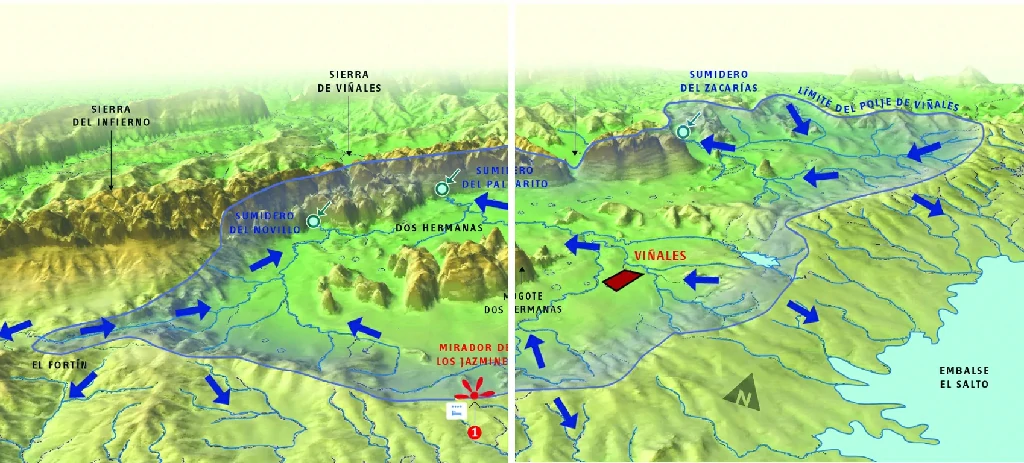
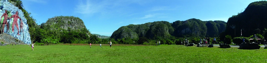
View of the isolated mogote of Zacarías, the incredible discovery of a closed valley (Hoyo de Jaruco), caves with fossils and cave paintings.

Difficulty
BY CAR EASY
ON FOOT EASY
Geological categories
MOGOTES
ROCKS
CAVES
TECTONICS
Duration
3 HRS

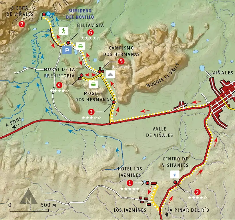
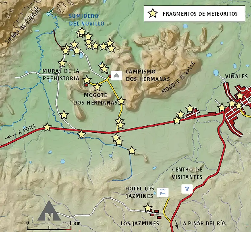
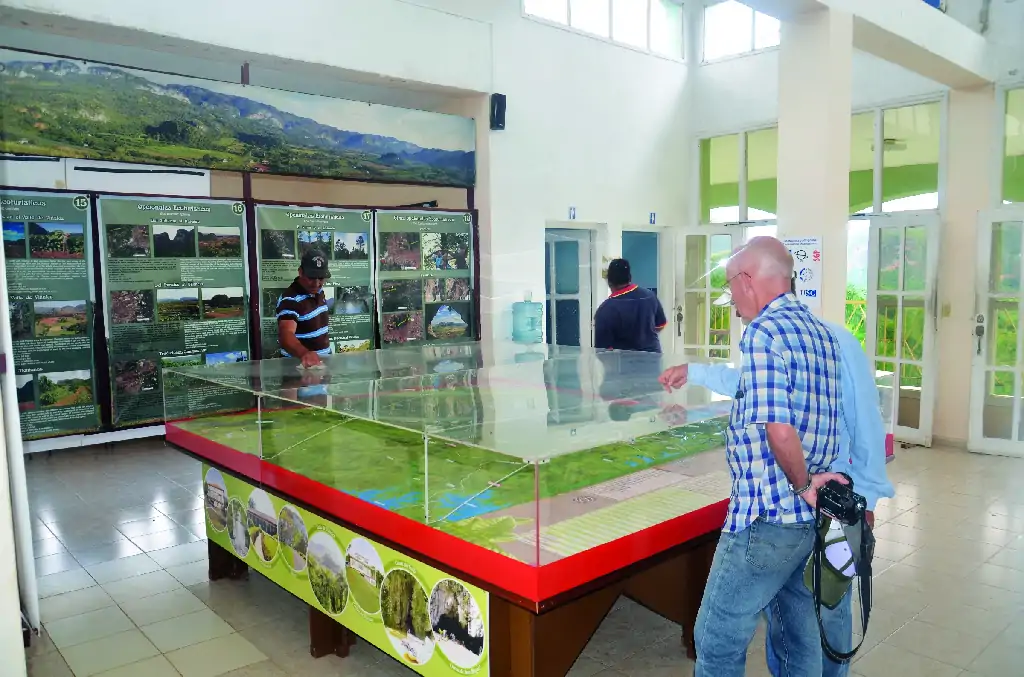
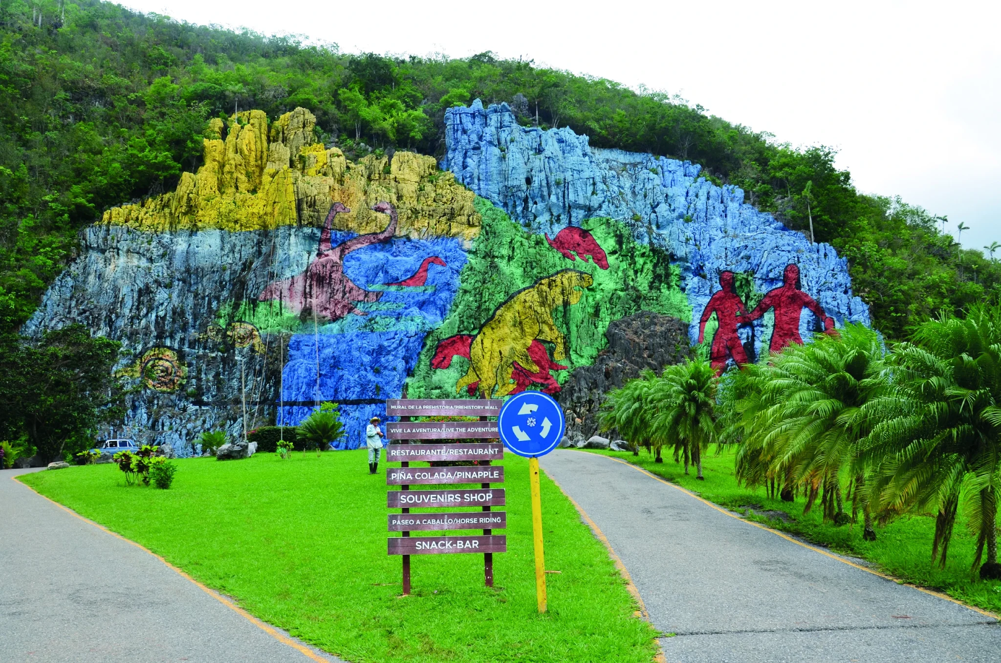
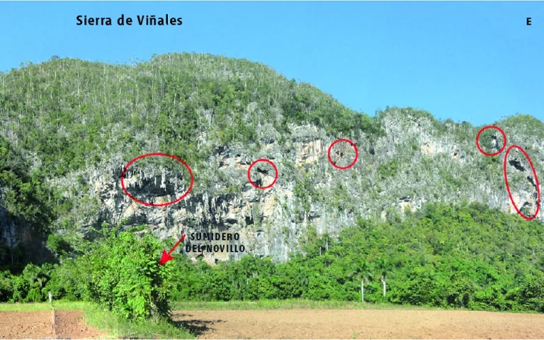
The itinerary begins at Los Jazmines, an exceptional viewpoint of the Viñales Valley, and visits the Viñales National Park Visitor Center with information and a model of the area. The next stop is at the entrance to Dos Hermanas, an example of rocks isolated by erosion that resemble a small "Stonehenge" Mural of Prehistory, allegorical paintings of the geological evolution of Cuba on the rocky wall of a mogote. Visit to the Dos Hermanas paleontological museum. Panoramic view to the south of the mogotes and Novillo sinkhole, a river that crosses the Viñales Mountains to resurface in the Ancón area (Itinerary 5).
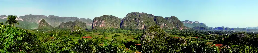
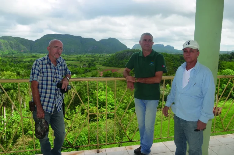
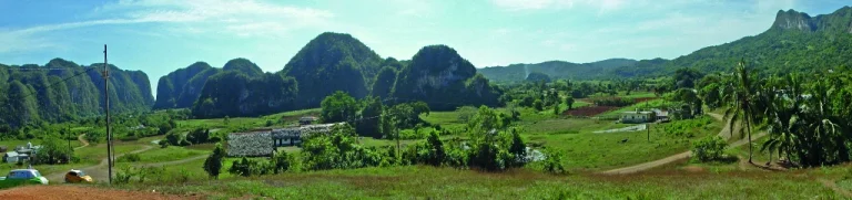
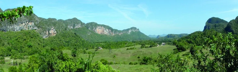
GEOSITES

1. Los Jazmines

Unique panorama

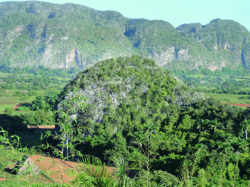
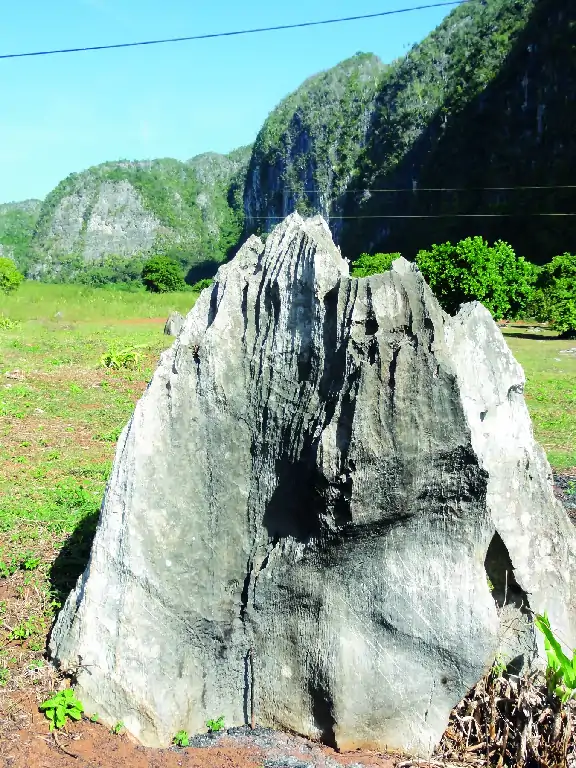
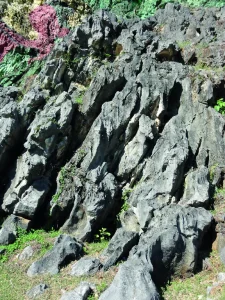
Mogotes of karst origin

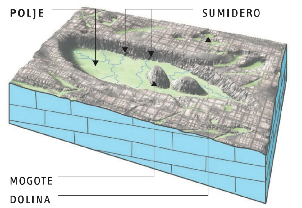
Karst evolution of Viñales Valley - Why are there mogotes?

2. Visitor Center

Geology

Natural sciences

The geological setting of Viñales

3. The small "Stonehenge"

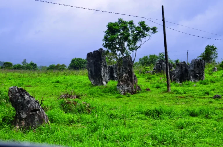
Isolated vertical rocks

Remains of superficial karst forms

Karst evolution of Viñales Valley

4. Mural of Prehistory

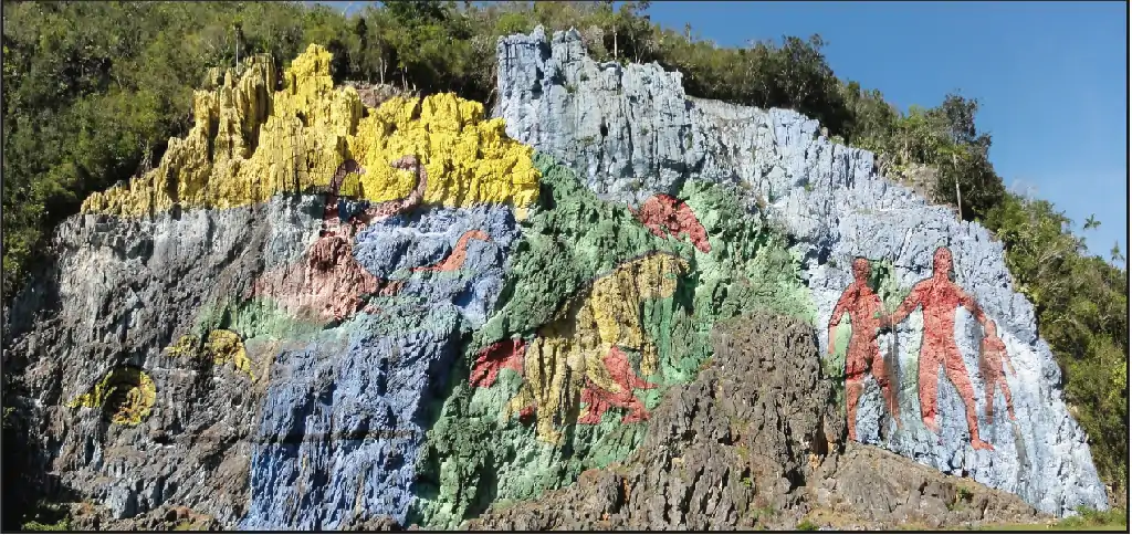
Mural on a rocky wall

Representation of Cuba's history
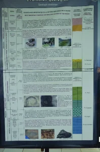
5. Dos Hermanas Paleontology Museum

Fossils

Fossil examples and information

The fossils of Viñales

6. 360° Panorama

Area surrounded by mogotes

Action of karst erosion

Karst evolution of Viñales Valley

7. Novillo Sinkhole

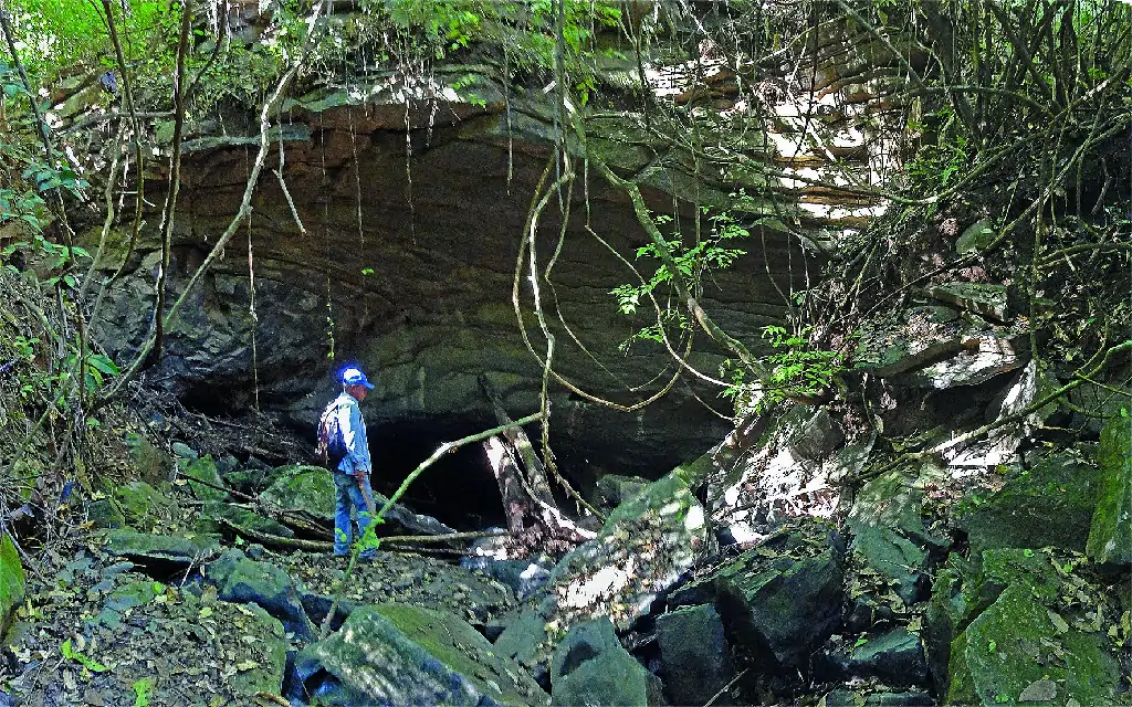
Stream entering a cave
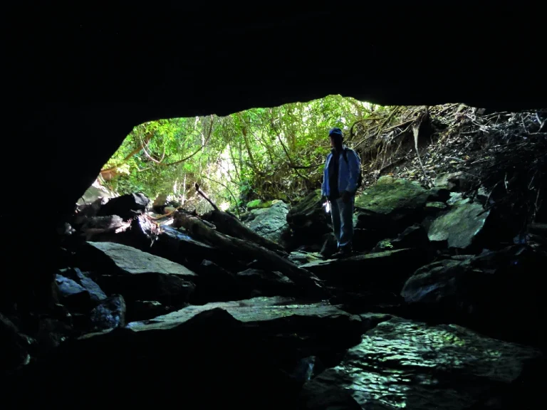
Karst sinkhole

Karst evolution of Viñales Valley

CURIOSITIES

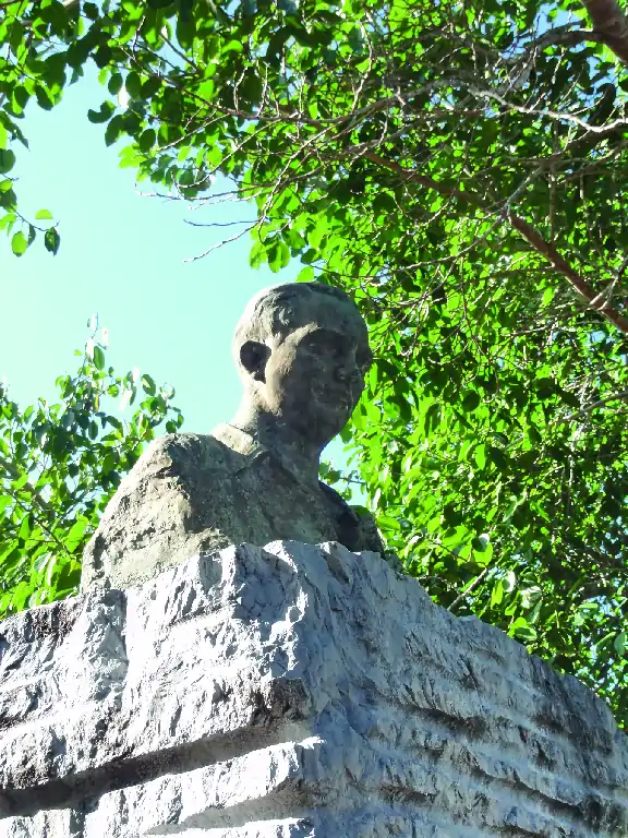
At the Los Jazmines viewpoint, there is a monument with a bust of the painter Domingo Ramos, considered the painter of the valley, as his landscape works made known to the entire world the beauty of the mogotes. He was born on November 6, 1894, in Güines, and died on December 23, 1956, at the age of 62. From an early age, he showed his vocation for painting and had the opportunity to study in Havana, at the San Alejandro Academy. He gained popularity from a contest organized by the magazine Bohemia in 1912; later, he received a pension from the Cuban government to continue his studies in Madrid, at the San Fernando Academy. In the early 1920s, he decided to settle in the Viñales area to dedicate most of his time to painting landscapes of the valley.

His international fame began in 1923, with a show of thirty-eight works exhibited in a venue of the Diario de la Marina in New York. This exhibition contributed to consolidating his prestige as a creator and making Viñales known. On that occasion, he won the bronze medal and provoked the astonishment of specialized critics who did not accept the idea that what was exhibited in Ramos's work was a real landscape. The viewpoint where we are is thanks to the efforts of the Lions Club, which in 1939 proposed building a viewpoint on the Loma de los Jazmines to facilitate the observation of the landscape, right in the place from where Domingo painted.

DOMINGO RAMOS, THE PAINTER OF THE VALLEY
MURAL OF PREHISTORY: ONE OF THE LARGEST OPEN-AIR FRESCOES IN THE WORLD.

The Mural of Prehistory, one of the largest open-air frescoes on the planet, represents the biogeological past of the region, with human and animal figures, now fossils, that inhabited this area. The majestic work, 120 meters high, is painted on Jurassic-period rocks with evident signs of karstification, especially in the upper part. It was created in 1959 by the painter and scientist Leovigildo González Morillo (a disciple of the Mexican muralist Diego Rivera).
The painter Leovigildo González together with Commander in Chief Fidel Castro Ruz and the dancer Alicia Alonso exchange about the work.

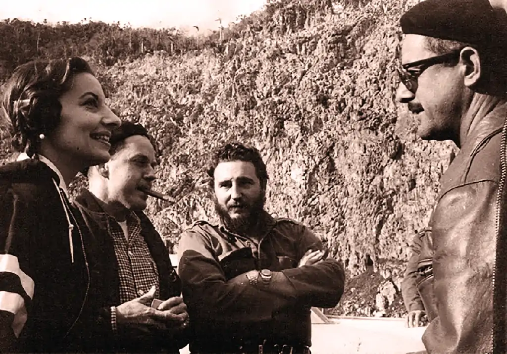
El pintor Leovigildo González junto al Comandante en Jefe Fidel Castro Ruz y la bailarina Alicia Alonso intercambian sobre la obra.

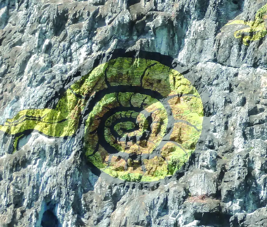
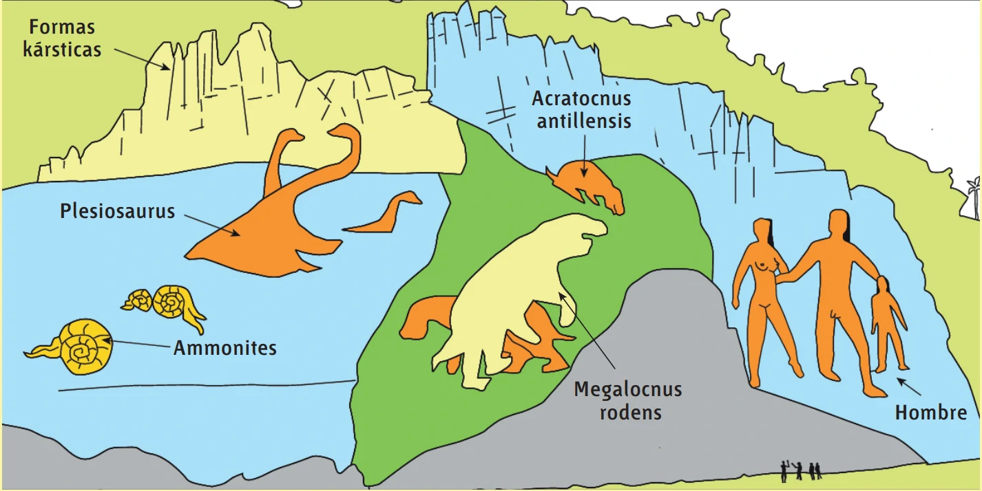
Lower Jurassic ammonites

The lower left part represents the oldest epoch of Cuba, the Jurassic, with an age of about 203 Ma. On a blue background representing the sea, three specimens of yellow ammonites have been represented, cephalopod mollusks with a spiral shell that lived at that time.

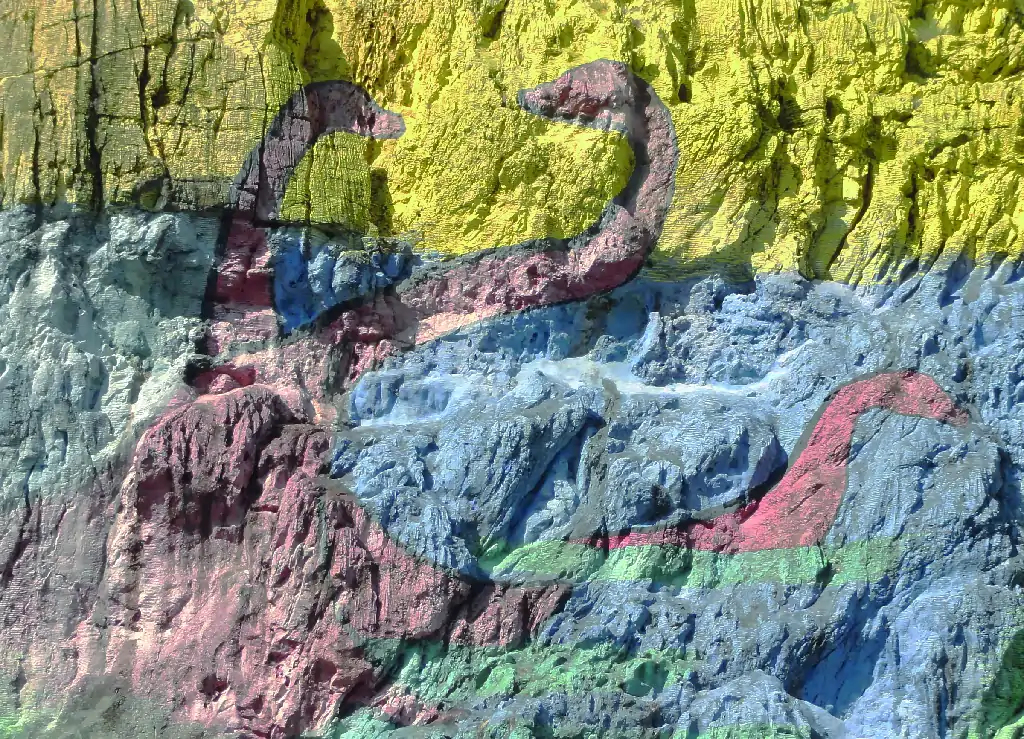
Plesiosaurus, aquatic reptiles from the late Jurassic

In the upper left quadrant, on the blue and yellow background, there are three red figures (two large and one small) representing a family of plesiosaurus, aquatic reptiles with a long neck that lived at the end of the Jurassic (about 150 Ma).

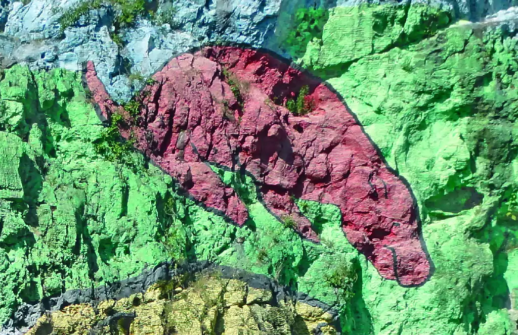
Acratocnus antillensis, an arboreal mammal from a million years ago, and two Megalocnus rodens sloths

In the center, there is an area painted green with three animal figures. The upper one, in red, represents an Acratocnus antillensis,

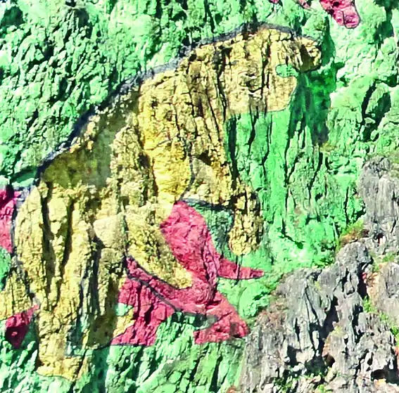
an arboreal mammal similar to the sloth that inhabited the emerged part of Cuba at the end of the Pleistocene, almost a million years ago. Below, there are two animals, one looking to the left in red and in front of it, another looking to the right in yellow. They are two specimens of Megalocnus rodens, other sloths of large dimensions (they measured 1.7 in length by 1.2 m in height) that lived in Cuba more than 1 Ma and became extinct about six thousand years ago.

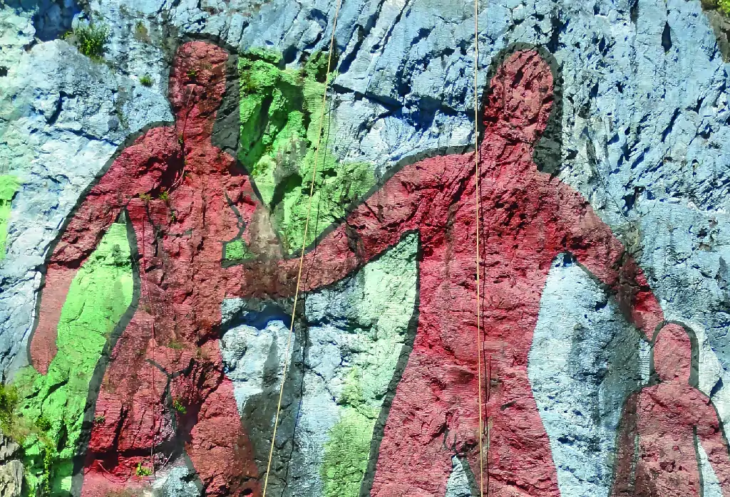
Family of aboriginal humans

The right part of the mural is entirely dedicated to aboriginal men. A family formed by a male, a female, and a son, painted in red with anatomical details that the other figures do not have.

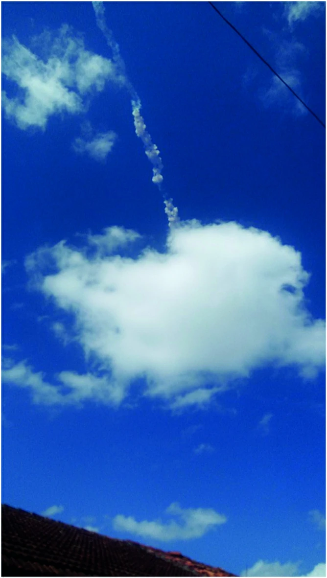
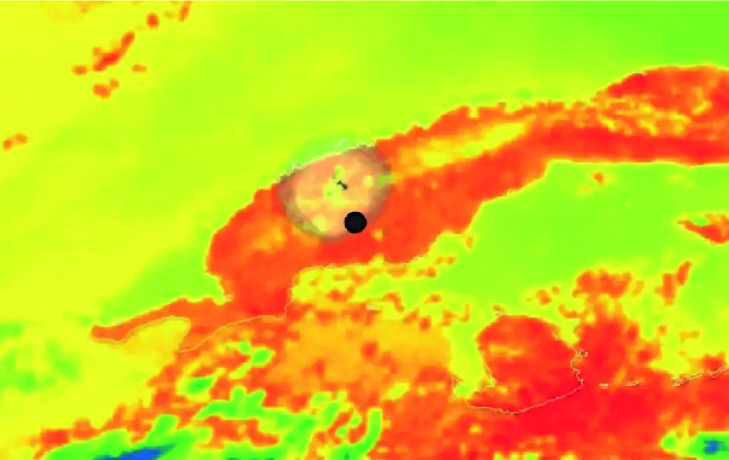
At noon on February 1, 2019, in the province of Pinar del Río, two large explosions were heard, and it was observed that in the sky there was a trace of dark gray to black smoke ending in a lighter gray cloud. At first, it was believed that it could be a plane accident, but later it was certified that the responsible was a meteorite that fragmented into numerous parts that scattered throughout the Viñales Valley, impacting buildings, roads, and the countryside in general. Scientists calculate that the meteorite was traveling at an approximate speed of 70 km/s, which makes one think of a body of considerable dimensions, possibly more than a ton in weight, which generated a great compression of the lower layers of the atmosphere causing the explosion of the body at a height between 80 and 110 km from the earth's surface. From this moment, the meteoroid suffers a deceleration, product of the fragmentation, generating a shower of small meteorites. The specimens collected in Los Jazmines, Viñales, and Palmar have between 3 and 5 cm in diameter, while at the bottom of Dos Hermanas Valley the dimensions of the meteorites are larger, reaching up to 11 cm, with a weight between 0.5 and 1.5 kg. Their composition is of magnesium silicates, in addition to the presence of several metallic minerals, such as iron and nickel. The presence of a fine fusion surface, less than 1 mm, makes one think that we could be in the presence of a stony meteorite, probably of the chondrite type, or stony-metallic, due to the presence of metallic minerals.

METEORITE SHOWER IN THE VIÑALES VALLEY
Scroll to Top

GEOSITIO 1 - LOS JAZMINES

Panorámica singular

Mogotes de origen cársico

Evolución cársica del valle de Viñales ¿Por qué hay mogotes?

El itinerario se inicia en el mirador de Los Jazmines, parada obligatoria para todos los visitantes a Viñales. La panorámica de los mogotes de Viñales es espectacular y emblemática. Estos mogo­tes son conocidos en todo el mundo y decla­rados por la UNESCO «Paisaje Cultural de la Humanidad» en diciembre de 1999.

A primer término se ve algún mogote aislado y un poco más al fondo el conjunto de mogotes de Viñales. A su izquierda se observa el valle que queda entre el mogote Viñales y el de Dos Hermanas, lugar a donde nos dirigiremos posteriormente. Al fondo, a occidente, está la sierra del Sitio Infierno y, a oriente, la sierra de Viñales y Guasasa. Un mogote es una forma originada por la erosión cársica en un clima tropical con for­ma de torre, cónica o de cúpula (ver parada 1 del itinerario 3). En esta pano­rámica podemos ver algún mogote de forma de cúpula, a primer plano, y más reiterados ejemplos de tipo torre. Aparte de la belleza del paisaje con mogo­tes, el valle de Viñales tiene una importante singularidad geológica difícil de observar en otros lugares: en realidad todo el valle se tra­ta de un gran polje. Un polje es un valle cerrado originado por procesos cársicos. Es decir, las aguas superfi­ciales no tienen salida por la superficie como un valle fluvial, sino que su única manera de desaguar es a través de sumideros que dre­nan hacia el subsuelo formando ríos subte­rráneos. En el caso de Viñales, los ríos subterráneos vuelven a resurgir en otros valles, como el caso del Palmarito que aflora en el Valle Ancón, o Zacarías que vuelve a la superficie en la Cueva del Indio.

GEOSITIO 2 - CENTRO DE VISITANTES

Geología

Ciencias de la naturaleza

El escenario geológico de Viñales

Volvemos a la carretera que une Viñales con Pinar del Río, en dirección Viñales y a me­nos de un kilómetro se encuentra el edificio del Centro del Visitante del Parque Nacional Viñales. En este centro podemos ver una maqueta de grandes dimensiones y detalle del valle. Hay numerosos paneles con información sobre el parque, ya sea de tipo biótico como geológico. Un balcón nos permite disfrutar de otra panorámica del valle de Viñales.

GEOSITIO 3 - EL PEQUEÑO «STONEHENGE»

Rocas verticales aisladas

Restos de formas cársicas superficiales

Evolución cársica del valle de Viñales

Continuamos la carretera en dirección a Vi­ñales, en la entrada del poblado, girar a la iz­quierda en dirección Pons. A unos 2,5 km, se encuentra a la derecha el desvío hacia Dos Hermanas que pasa por un abra espectacular entre el Mogote del Valle y el de Dos Hermanas. Estacionamos el vehículo y nos dirigimos a pie a un prado con unas rocas verticales dispersas formando, aproximadamente, un círculo que se les denomina, informalmente, «stonehenge», por su parecido, guardando las distancias, al célebre monumento mega­lítico de Inglaterra. En realidad, las rocas que podemos obser­var no están puestas por el hombre, como es el caso del auténtico Stonehenge, sino que son restos de un macizo calcáreo que existía en este lugar y que la erosión cársica ha ido desmantelando poco a poco hasta dar lugar a este paraje peculiar. Si nos acercamos, vemos que las rocas pueden tener entre 1,5 y 2,5 metros de altura y presentan una erosión superficial en aca­naladuras denominadas karren.

GEOSITIO 4 - CALIZAS DE PALEOCENO

Mural en una pared rocosa

Representación de la historia de Cuba

Seguimos por la carretera en dirección norte, hasta llegar a la entrada del Mural de la Prehistoria. Estacionamos el vehículo en el parque y seguimos a pie hasta el mural rupestre. En 1959, fue creado el denominado Mural de la Prehistoria, por el pintor Leovigildo González Morillo, en la pared escarpada del mogote Dos Hermanas el cual representa la evolución de la vida en Cuba.

La ladera casi vertical que contiene el mu­ral, se limpió previamente para poder realizar este trabajo y se hicieron drenajes para evitar la erosión a causa de la lluvia. Es uno de los mayores frescos a cielo abierto del planeta, con 120 metros de altura y 160 de ancho. Su fama es notoria ya que desde hace más de 55 años ha sido visitado por turistas nacionales y extranjeros para admirar, tanto su contenido como el valor artístico de tan monumental obra, al tiempo que degustan bebidas y pla­tos de la cocina tradicional cubana.

La situación es inmejorable, rodeado de los mogotes del Valle y de Dos Hermanas le confiere un ambiente especial. Si nos acer­camos al mural, las rocas calizas con acana­laduras de lapiés nos recuerdan el origen cársico de los relieves del valle de Viñales. En el febrero del 2019 un meteorito cayó y explotó justo antes de llegar al valle de Vi­ñales, diseminando numerosos fragmentos. Varios de los cuales impactaron en edificios como es el caso del restaurante de Dos Her­manas. Afortunadamente no hubo daño a personas.

GEOSITIO 6 - PANORÁMICA DE 360°

Zona rodeada de mogotes

Actuación de erosión cársica

Evolución cársica del valle de Viñales

En el entronque de la carretera que va al Mural y junto a la entrada del campismo, hay un camino de tierra en dirección norte. Seguimos esta pista y a 1,1 km se llega a una pequeña colina con un mirador en su parte superior llamado Bellavista. Esta­cionamos el vehículo y ascendemos unos metros hasta el mirador.

Desde este punto tenemos una visión en 360º de un paisaje bastante desconocido por muchos de los visitantes. Hacia el norte y el oeste tenemos una clara visión de todo el escarpe sur de la sierra de Viñales, desde Sitio del Infierno al oeste, hasta la sierra de Guasasa al este. Por el oriente, a lo lejos se puede distin­guir el mogote Zacarías y más próxima la sierra de Tumbadero. Por el sur, los mogotes de Dos Hermanas y el abra que da acceso al valle. Más al sur, en el extremo suroccidental se observa la Loma del Fortín. Como hemos visto en la parada 4, esta zona fue una de las más afectadas por la caída de meteoritos del 2019. Uno de ellos impactó en el voladizo del tejado del mira­dor de Bellavista dejando una marca en el edificio.

GEOSITIO 6 - SUMIDERO DEL NOVILLO

Arroyo que penetra en una cueva

Sumidero cársico

Evolución cársica del valle de Viñales

Descendemos unos metros del mirador de Bellavista y continuamos a pie la pista en dirección oeste y poco después en dirección noroeste. Al cabo de un kilómetro entramos en una zona boscosa al pie del acantilado calizo de la sierra de Viñales. Cruzamos el río que puede llevar más o menos agua según sea la estación de lluvias o seca. 

En unos 100 metros el río penetra en el subsuelo a través de una cueva. Se trata del sumidero del Novi­llo que forma parte del sistema subterráneo de Novillo-Palmarito Un conjunto de galerías de más de 50 km y el trasvase de las aguas de la zona de Viñales al valle Ancón a través de ríos subterráneos. La boca de la cueva tiene una forma elíp­tica de unos 10 metros de ancho por 2-3 me­tros de alto. En el suelo se acumulan lozas planas de calizas, fragmentos caídos del te­cho y restos de vegetación arrastrados por el agua. En la parte izquierda de la entrada, se puede observar como las capas de calizas es­tán plegadas formando un pliegue tumbado.  Como vemos en la imagen, el plano axial está muy inclinado hacia la izquierda casi horizontal. De esta manera tenemos dos flancos, el superior en donde las capas están normales (las más antiguas debajo y las más modernas arriba) y el flanco inferior que está invertido, es decir las capas más moder­nas están debajo y las más antiguas arriba.