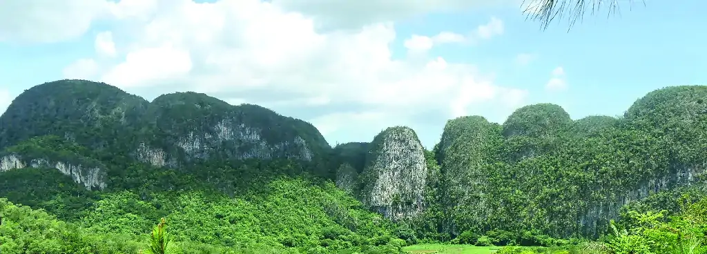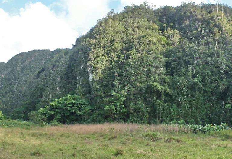

Panoramic view of the Mountains and Gap of Ancón, spring of the Abra River, and violet limestones of the Ancón Formation.

BY CAR EASY

ON FOOT EASY

MOGOTES

ROCKS

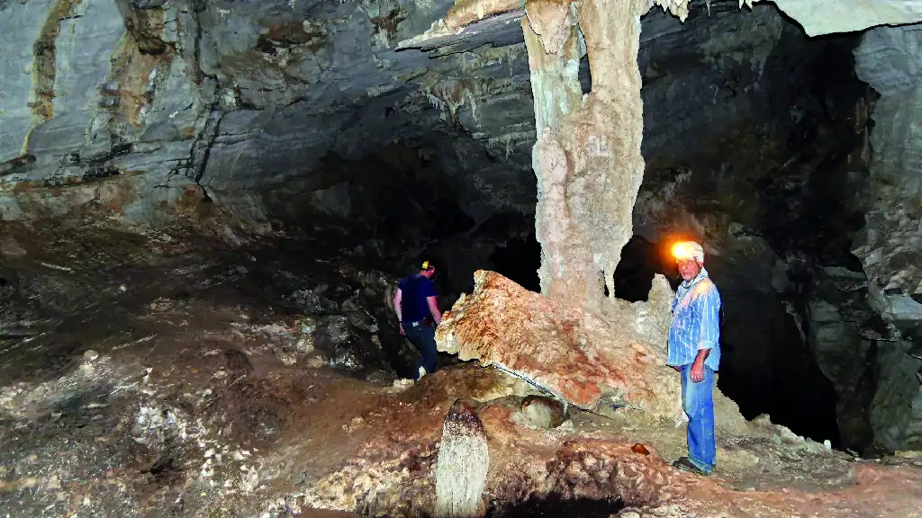
CAVES

GEOLOGICAL RESOURCES

2 HRS
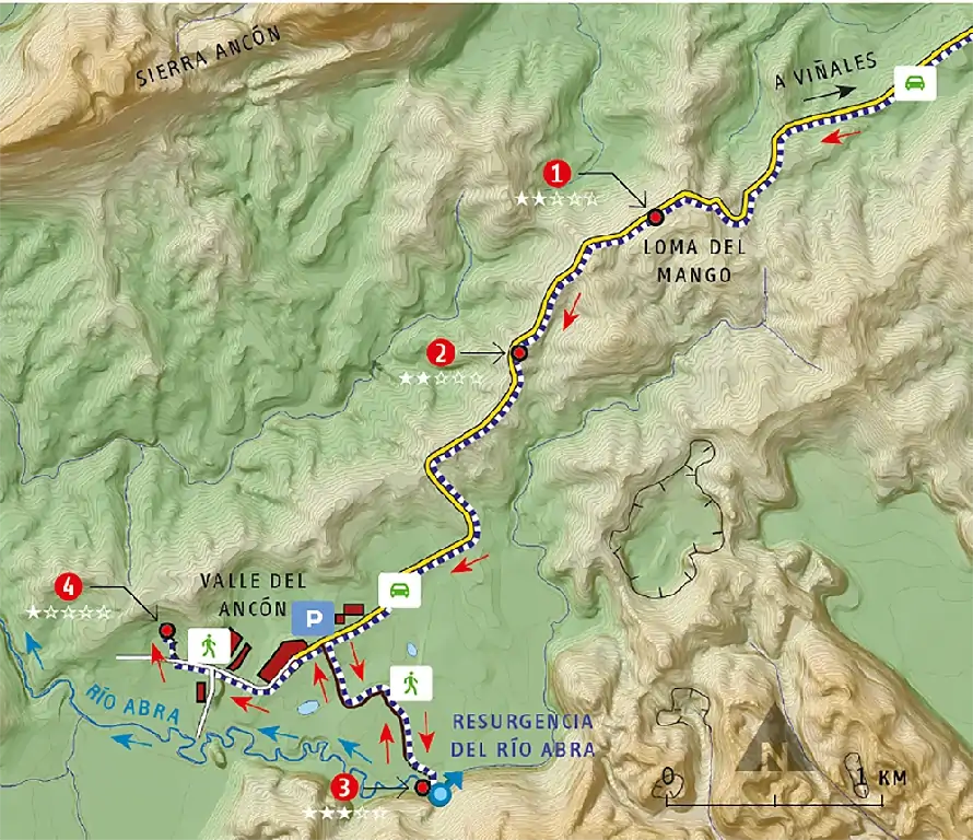
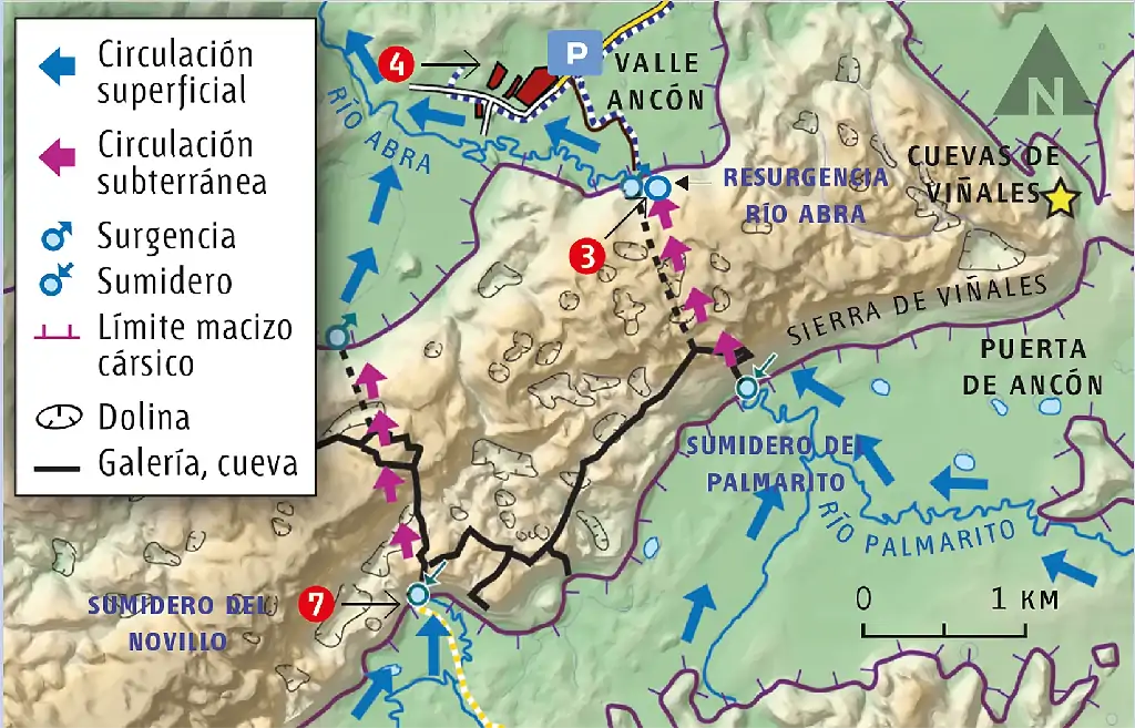
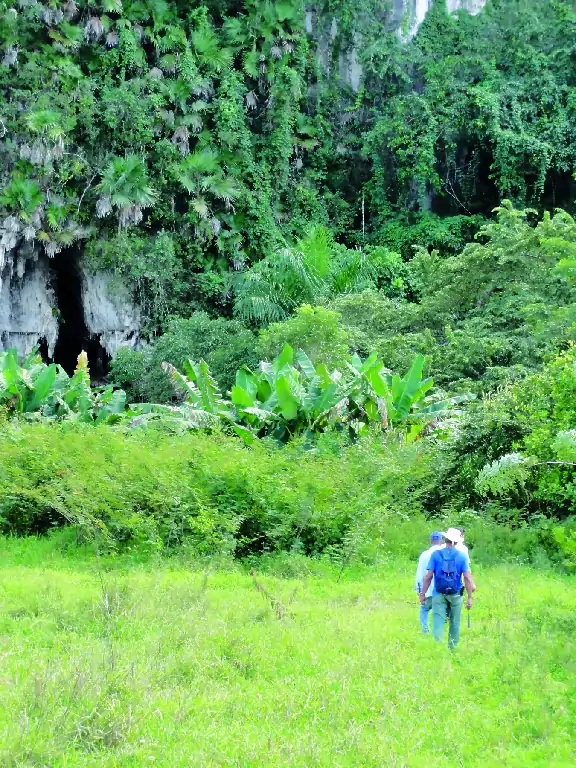
Itinerary through the Ancón Valley, with views of the Ancón Mountains and the gap that cuts the mountains in two. The entrance to the spring cave of the Abra River is visited. This underground river is the outlet of the Palmarito River, which on the other side of the Viñales Mountains, more than 1.5 km away, goes underground at the sinkhole also called Palmarito.


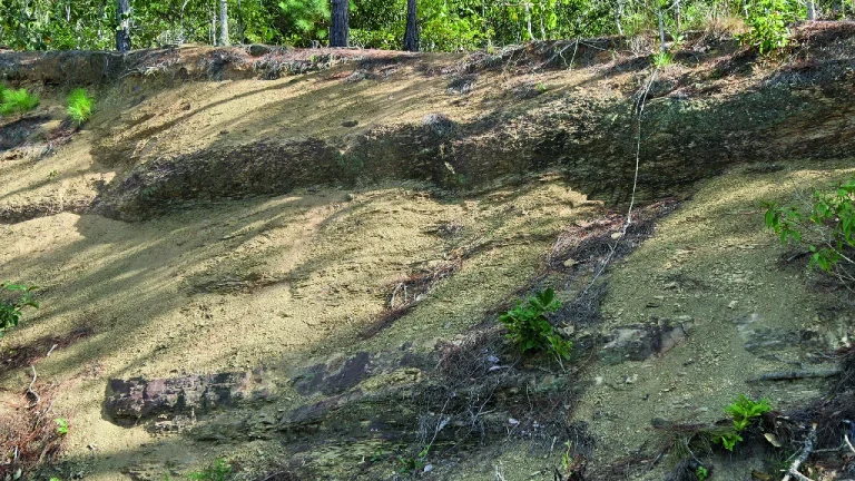
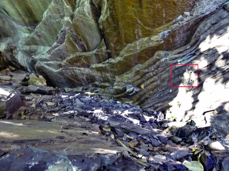
Slaty rocks

San Cayetano Formation

Karst evolution of the valley
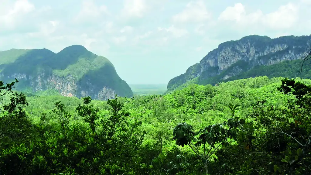
Narrow valley separating two mountains
Karst canyon
Karst evolution of Viñales Valley

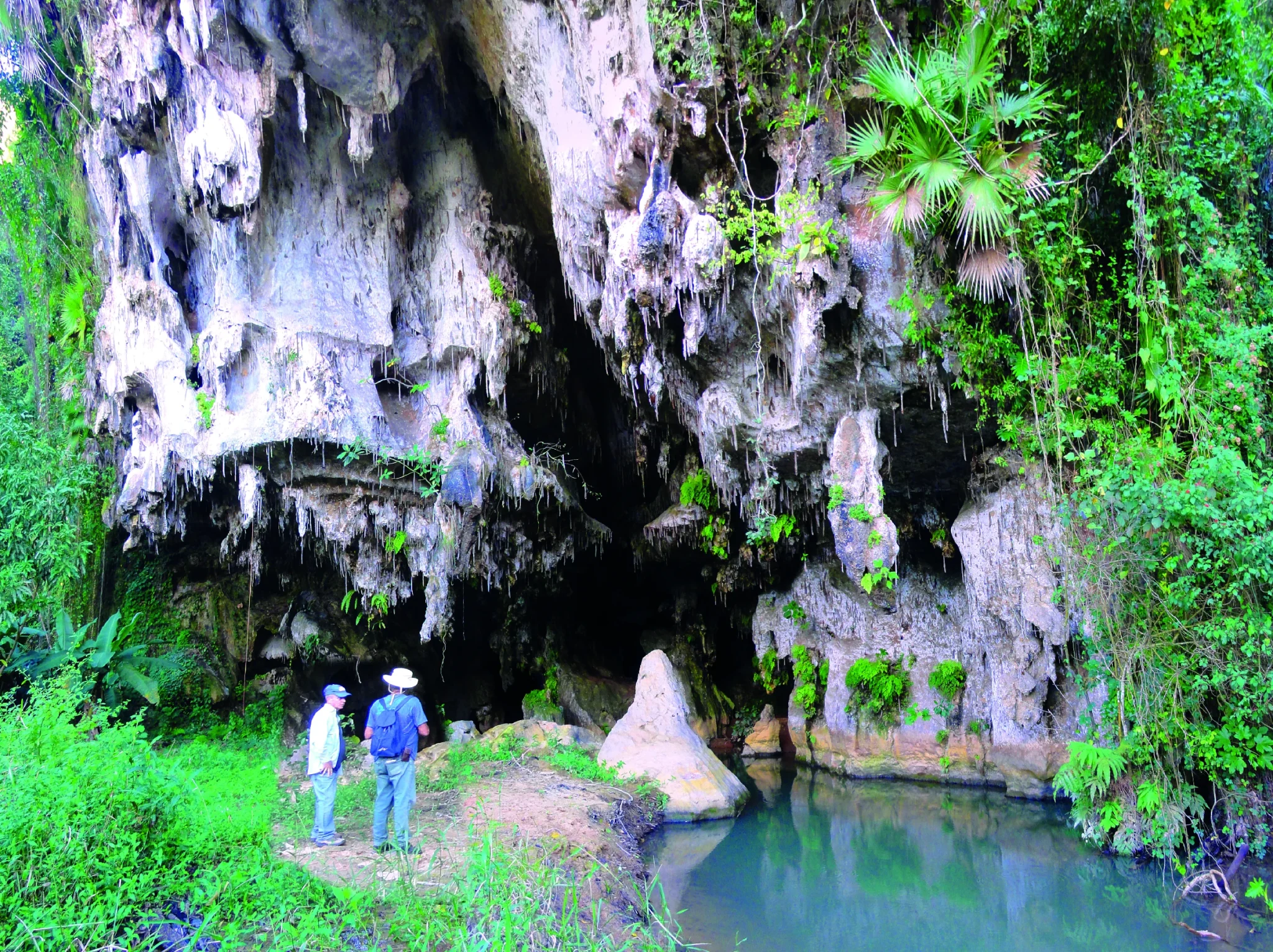
River emerging from a cave
Resurgence
Karst


Violet-colored limestones
Limestones of the Ancón Formation
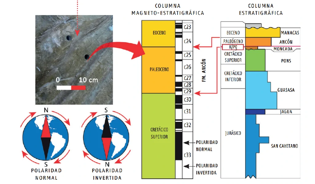
The stratigraphic column