GEOLOGY OF CUBA
THE CARIBBEAN PUZZLE
Cuba’s tectonic structure is quite complex, as it is a piece of crust that originated in the Jurassic period, about 190 million years ago, in a location where the Pacific Ocean now lies. This piece of crust has traveled over 2,000 km to collide with the North American plate, which now includes the Florida peninsula and the Bahamas, about 65 million years ago.
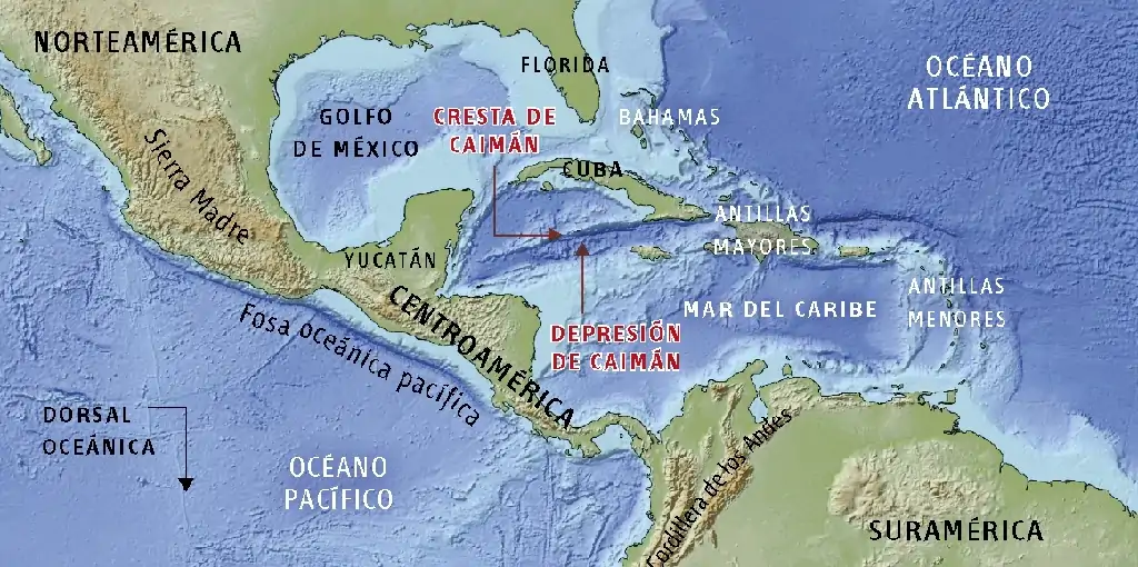
If we observe the Caribbean relief, we see mountain ranges with an approximate NW-SE direction in western North America, Central America, and South America, corresponding to the Sierra Madre and the Andes. To the east, we see the Greater and Lesser Antilles with curved shapes. Analyzing the seafloor relief, as shown, we observe a large trench in the Pacific Ocean with a NW-SE direction and a stepped zone south of Cuba (Cayman Ridge and Trough) separating it from Hispaniola. All these forms are explained by plate tectonics, involving a mosaic of tectonic plates with different types of contact between them.
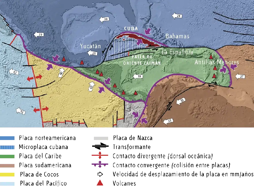
The limits of the plates in the Caribbean region have been represented. To the north is the North American Plate (blue); to the south, the Caribbean Plate (green); between them lies the Cuban Microplate (blue with white stripes) and further south, the South American Plate (brown). To the west is another small plate called the Cocos Plate (yellow), and further west, the large Pacific Plate (light blue). South of the Cocos Plate lies the Nazca Plate (gray).
CUBA, THE TRAVELER ISLAND
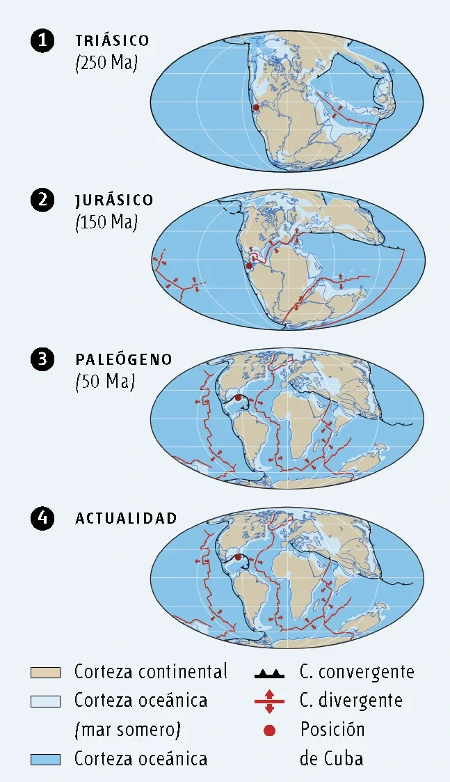
To explain Cuba’s 2,000 km journey from the Pacific to its current location, we must go back about 250 million years. In the Triassic (250 Ma), all continents were united in a supercontinent called Pangea. At the beginning of the Jurassic (150 Ma), the Atlantic began to open, forming two supercontinents: Laurasia to the north and Gondwana to the south. Cuba would have been located at the western edge of the boundary between the two supercontinents. Gradually, new plates separated, and by the Paleogene (50 Ma), a mosaic of highly active plates had formed. The itinerary of the Caribbean Plate can be observed with current geography. Around 120 Ma, it was located in the Pacific region, slowly moving eastward to its current position. Cuba was part of the Caribbean Plate, but its trajectory took it further northeast, colliding with the North American Plate, specifically the Florida and Bahamas region, where it stopped, while the Caribbean Plate continued its eastward journey to its current location.
Want to Know More?
Discover it in our geological guide to Viñales Geopark!
These are just some of the fundamental concepts that will help you appreciate the geology around you. If your curiosity is piqued and you wish to delve deeper into Viñales’ geological secrets, we invite you to acquire our complete guide.
Perfect for curious travelers, students, teachers, and nature lovers.